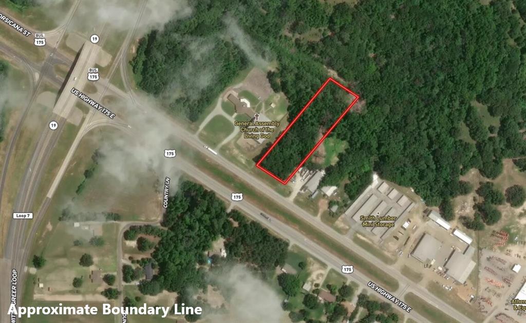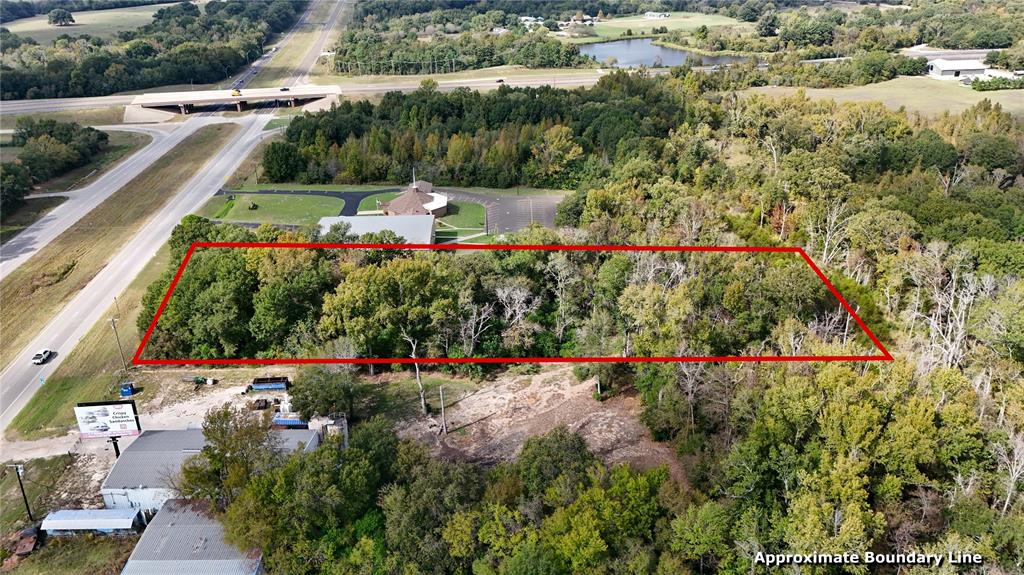
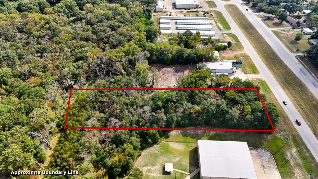
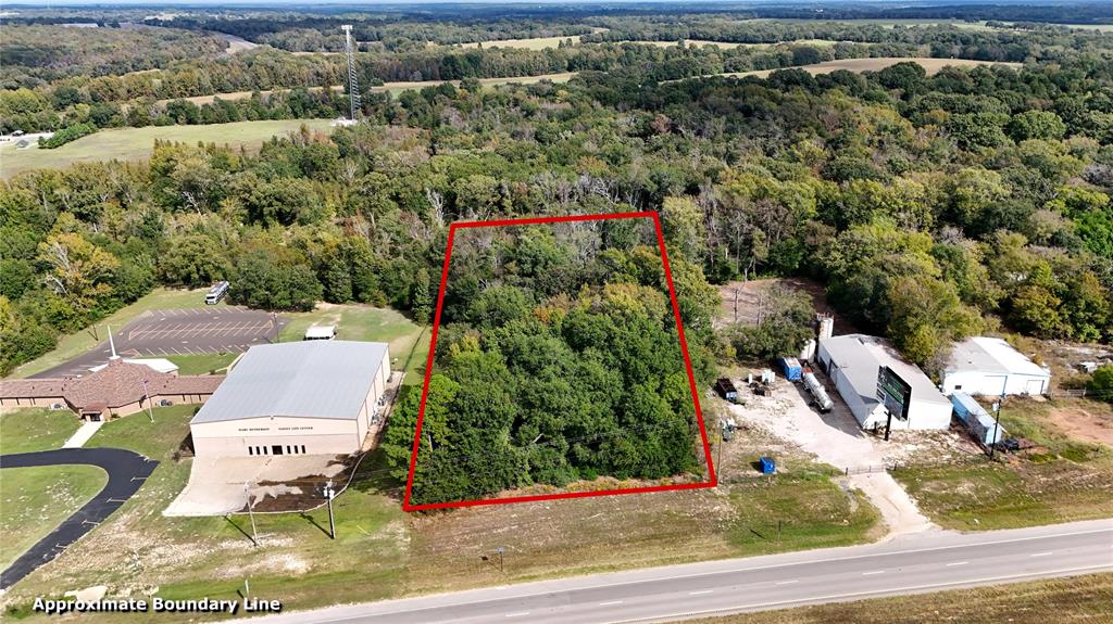
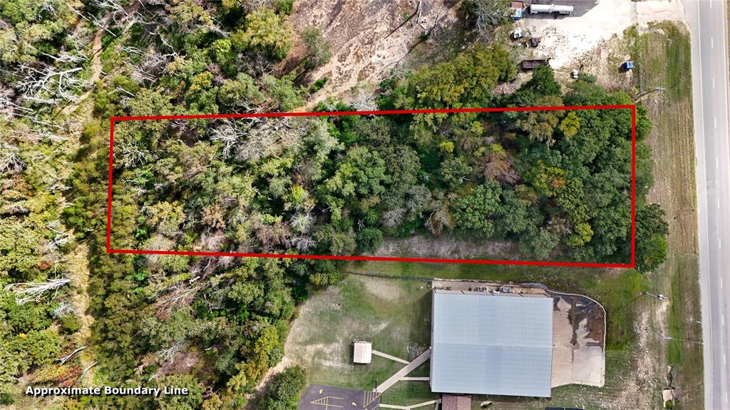
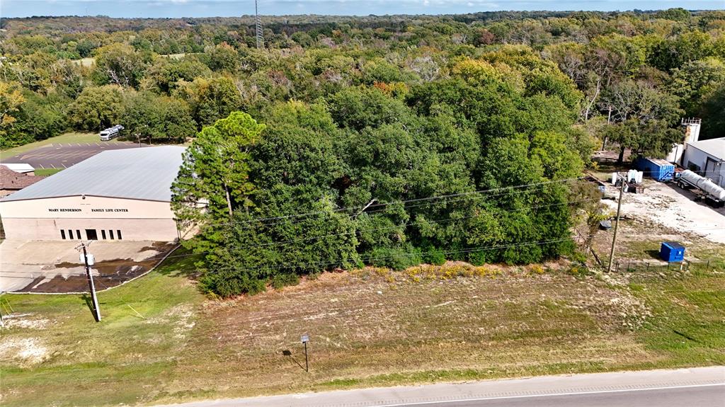
Approximate two acres right outside the city limits on the heavily trafficked HWY 175. With utilities in the area, approximate 135 feet of road frontage, and approximate 4,423 cars driving by per day (per TxDOT), this property offers high visibility and potential for commercial, recreational, or residential use.
| Listing Id: | 21432248 |
|---|---|
| List Price: | $110,000 |
| Property Type: | Commercial Sale |
| Property Sub Type: | Unimproved Land |
| Status: | Active |
| Unexempt Taxes: | $129 |
| Lot Size Square Feet: | 87,120.0000 |
| Lot Size Acres: | 2.0 |
| Waterfront?: | No |
| City: | Athens |
| County Or Parish: | Henderson |
| Subdivision Name: | Na |
| Postal Code: | 75752 |
| Year Built: | 9999 |
| Basement Yn: | No |
| Building Area Source: | Plans |
| Building Use: | Other |
| Business Type: | Other |
| Construction Materials: | Other |
| Directions: | From Athens, take HWY 175 east, drive under and past the loop, turn left and then left again onto HWY 175 west. Property between Smith Lumber and Church of the Living God. |
| Lot Size: | 1 to < 3 Acres |
| Lot Size Area: | 2.0000 |
| Lot Size Source: | Public Records |
| Lot Size Units: | Acres |
| Multi Parcel ID: | Yes |
| Multi Zoning?: | No |
| Municipal Utility District?: | No |
| Possession: | Closing/Funding |
| Road Frontage Type: | Highway |
| Utilities: | All Weather Road, Electricity Available, Outside City Limits |
| Will Subdivide: | No |
| Year Built Details: | Unknown |
| Zoning Description: | none |
Listing Courtesy of: Steve Grant Realty LLC
Listing Agent: Nick Grant
903-675-3503
Mortgage Calculator
All listings featuring the  icon are provided courtesy of North Texas Real Estate Information Systems, Inc. (NTREIS), Copyright 2026. All rights reserved.
All information is believed accurate but not guaranteed. The properties displayed may not be all of the properties available through the IDX Program. Any use of this site other than by potential buyers or sellers is strictly prohibited.
North Texas Real Estate Information Systems, Inc. data last updated on November 10, 2026 11:06 AM - CT
Property Last Updated: November 10, 2026 11:06 AM - CT